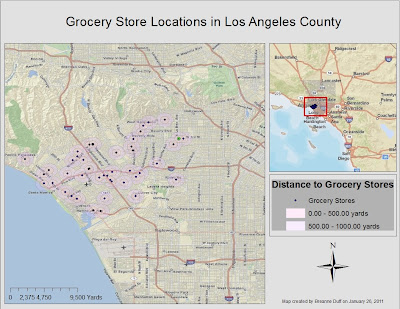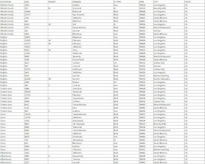
My goal was to create a map that could be used to determine the distance of a residence to the nearest grocery stores. Close proximity to grocery stores is an integral factor in deciding where to live. The store itself can be an influencing factor, and can also be seen as an indicator of a neighborhood's economic demographics. For instance, Whole Foods grocery stores often carry "organic" food products that are priced higher than food products sold at Albertsons; the presence then of a Whole Foods market can not only garner or deter affinity for the area from prospective buyers, but can often be used as a gauge for an area's relative affluence. After determining the addresses of 50 different grocery store locations in Los Angeles County, I was able to compile a spreadsheet in Excel to be used for importing and joining in ArcGIS.


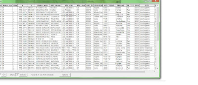
While the geocoding tool is incredibly useful for matching and labeling points on ArcGIS maps, it can be tedious, and gathering all the right components can be difficult. Whereas manually inserting addresses into a layer's attribute table would be arduous, creating a spreadsheet in Excel is no easy task. Inputing each store name, address, zip code, etc...can be a painstaking process, espcially when each column name must be identical to the corresponding names in the layer attribute table, and when addresses need to be broken down by each component, from building number to street type (Rd, Ave, Blvd). I tried numerous times to join my spreadsheet to the attribute table only to find all my columns were "Null." And (after making and) using an address locator, any unmatched or tied data must be parsed out and fixed before geocoding can be completed. But geocoding did help to discover where grocery stores can be found in LA County and their relative distance to each other and surrounding neighborhoods.


Geocoding is an incredibly useful tool to help represent specific point locations on maps with road features, or even those that have polygon shapefiles. With the geocoding application, creating a map with address details is a much faster process than if the user had to hunt and peck for places on far ranging maps. The address locator assimilated my hand built address table into the attribute table of my roads layer to match them up and provide the recognized locations with individual points. From there, I created buffers for each point to show the relative distance around the store. These buffers would then give current or prospective homeowners/renters an idea of grocery store chains adjacent to their residences, as well as approximately how far (in yards) those stores were from their homes.
While the geocoding tool is incredibly useful for matching and labeling points on ArcGIS maps, it can be tedious, and gathering all the right components can be difficult. Whereas manually inserting addresses into a layer's attribute table would be arduous, creating a spreadsheet in Excel is no easy task. Inputing each store name, address, zip code, etc...can be a painstaking process, espcially when each column name must be identical to the corresponding names in the layer attribute table, and when addresses need to be broken down by each component, from building number to street type (Rd, Ave, Blvd). I tried numerous times to join my spreadsheet to the attribute table only to find all my columns were "Null." And (after making and) using an address locator, any unmatched or tied data must be parsed out and fixed before geocoding can be completed. But geocoding did help to discover where grocery stores can be found in LA County and their relative distance to each other and surrounding neighborhoods.
No comments:
Post a Comment